The PoleOS™ Company

The IKE Suite
IKE and its suite of industry-leading data acquisition and structural analysis tools helps utilities, engineering firms, and communications companies efficiently acquire and dependably analyze the data needed to properly assess and maintain grid infrastructure.
Learn About the IKE SuiteIKE Office Pro is a cloud-based software platform that takes the data acquired in the field with the IKE Device and creates a standardized digital twin of accurate, defendable pole records.
3X
efficiency improvements50%
reduction in recollects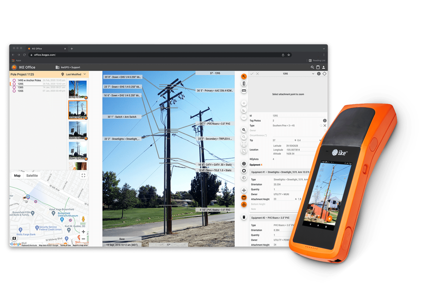
With the all-new IKE PoleForeman, the industry’s benchmark structural analysis software has evolved with new features and is poised to continue being the go-to tool for organizations tasked with maintaining the integrity of the grid’s physical infrastructure for the next two decades.
7
of the 10 largest IOU’s trust PoleForeman22
years of defendable pole load analysis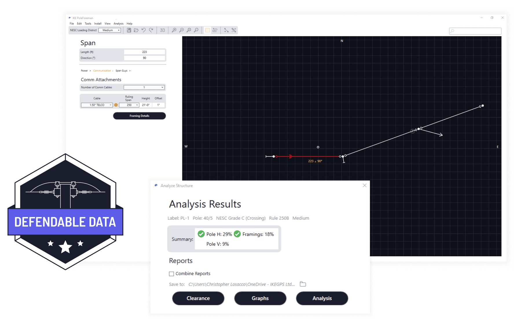
IKE Insight is the industry’s go-to tool for gaining actionable insights from new or existing digital imagery or data sources, including drone, lidar, aerial, satellite, or thermal.
20K
new attachments found for pole owners30%
increase in joint use revenue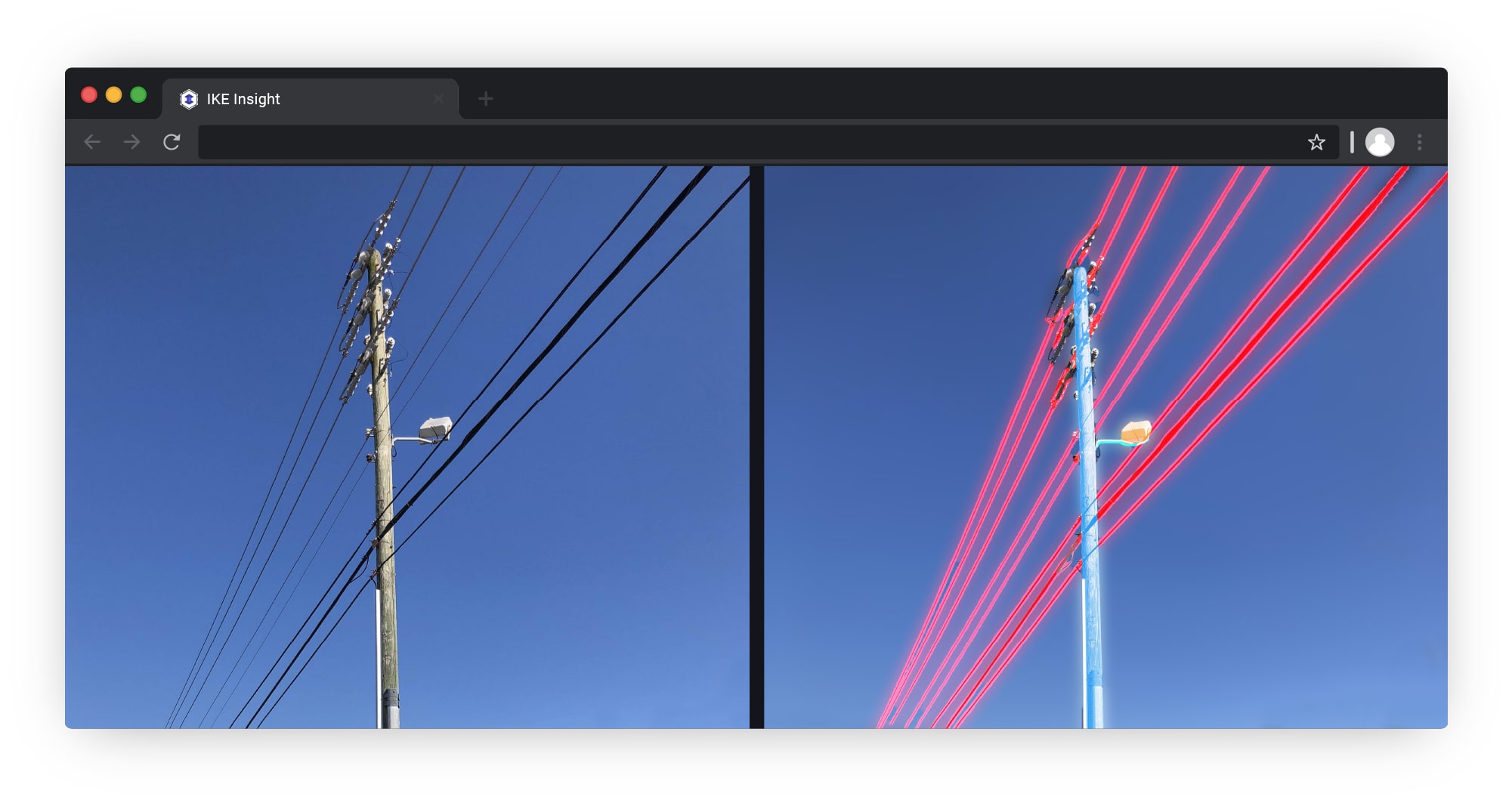
IKE PoleForeman Launch Event
Watch the launch event hosted by IKE PoleForeman creator Malcolm Young.
Malcolm showcases an overview of the software and explains some of its key features.
The latest from the IKE Wire
Communications
/ 2 Min Read
Slow Permitting Approval Process? There’s a Federal Committee for That.
For communications companies seeking to expand broadband networks to new customers, a...
Read More
Engineering
Why are High Voltage Overhead Wires Bare?
The electrical cords that help power everyday life in our homes and workplaces are co...
Read More
Utilities
Transforming Utility Work: Three Technologies and the Power of GIS Data
Over the past two decades, technological advancements have been reshaping the utility...
Read MoreSubscribe to the IKE Wire
Get the latest insights on data acquisition and structural analysis from the ikeGPS experts.
An ikeGPS Reader
Federal Funding Opportunities for Electric Utilities
A guide to the legislation and funding dedicated to improving our nation’s electrical grid.
This short book is a guide to understanding the key pieces of recent US legislation that make funding available to organizations that provide grid services or operate our nation’s grid so it may serve the American public to the fullest.
DownloadYou’re in good company


